Stop 4:
West Main Street
(around Cribb’s Kitchen or Main St. Pub)
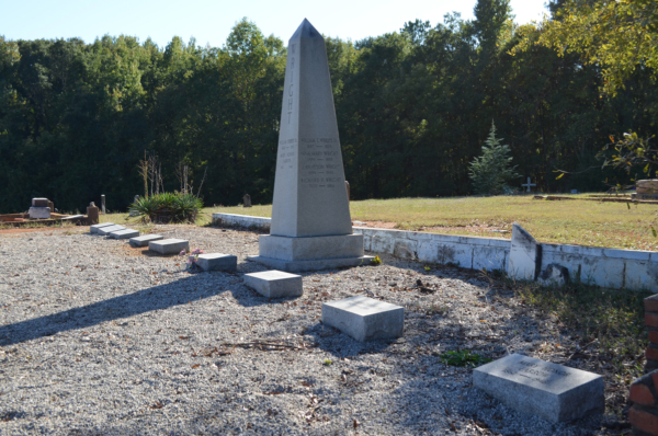
Photo credit: Brad Steinecke
The graves originally located along West Main Street were moved to this cemetery in the Southside community in 1910 to make way for a railroad expansion.
For most of Spartanburg’s existence, topography limited downtown’s western growth. Directly west of town, the land gets quite hilly as you approach Fairforest Creek, the watershed that includes Morgan Square and a lot of the land west of Church Street. Hilly lands aren’t much for an automobile on paved roads, but for a loaded wagon trying to slip its way up a muddy incline, it’s another matter.
The southwest part of downtown has a long association with the black community. The town’s original black cemetery once lay near here on the south side of West Main Street where the railroad tracks are now. Like its white equivalent, Magnolia Street Cemetery, it probably began being used around the turn of the 19th century. So it was around a century old in 1910, when the railroad worked out a deal with the city to move the last of the known graves to Cemetery Street in the Southside neighborhood.
It’s difficult to see it now, but past the railroad tracks, Main Street crosses over a small stream, which has been diverted into underground culverts through much of its course. That little stream, one of downtown’s few waterways, has had several colorful nicknames over the years. In the mid-1800s a tanyard notoriously used the stream to empty the vats of acids used to tan leather, giving the little stream an awful smell. For that reason, many folks knew the creek as the “Nasty Branch.” The stream is now the centerpiece of a greenway initiative on the Northside and is called Butterfly Creek.
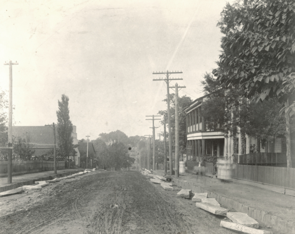
Image courtesy of the Spartanburg County Public Libraries
This view of West Main Street just past Morgan Square around 1900 illustrates just how much in-fill and pavement have transformed the area.
Audio: Stop 4 - The Grain District